
SPH - MagNIMBUS - magnetometer (QuSpin QTFM Gen-2 sensors)
Ultra-sensitive airborne magnetometer for drone
The MagNIMBUS is an integrated airborne magnetometry system powered by QuSpin QTFM Gen-2 atomic sensors, known for their very high sensitivity and stability. Specifically designed for drone integration, it enables fast, precise, and repeatable surveys over large areas, with simplified logistics compared to helicopter or ground-based solutions.
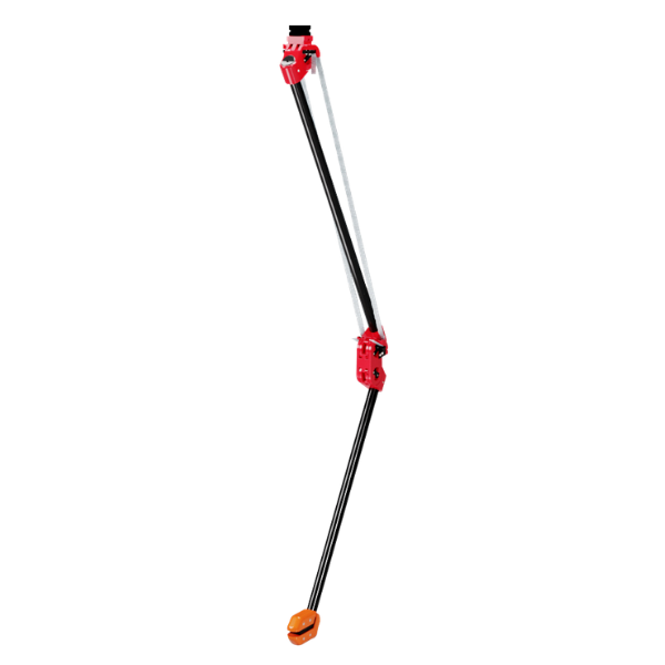
Unique design: very low flight close to the ground (safe)
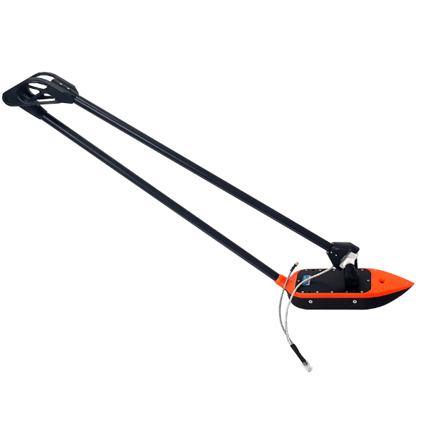
The MagNIMBUS stands out with its self-folding sensor mount, which allows flying with an extremely low ground-to-sensor clearance (a few dozen centimetres).
-
If the sensor touches the ground, vegetation, or an obstacle, this does not cause the drone to crash.
-
This ability is crucial for detecting small objects (e.g., small UXO) in fields with vegetation.
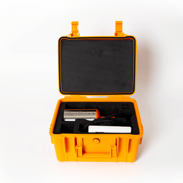
System architecture (main components)
The standard system includes:
-
Recommended drone: DJI M350 RTK or M300 RTK (mounting kits provided).
-
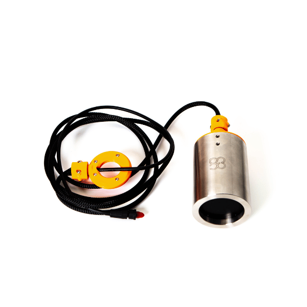
Foldable mount with integrated QuSpin QTFM Gen-2 sensor.
-
Mast with second QuSpin Gen-2 sensor for gradiometer configuration.
-
SkyHub (onboard computer): records magnetic data and manages terrain tracking.
-
Altimeter (radar or laser) for controlled very low altitude flight.
-
UgCS Expert for mission planning and execution.
-
Recommended processing: Geosoft Oasis Montaj.
Two possible configurations
1) Gradiometer (recommended in most cases)
-
Simplifies data processing.
-
Makes a magnetometer base station unnecessary.
-
Allows surveys near electromagnetic sources (e.g., power lines).
2) Single sensor (foldable mount alone)
-
Same raw detection capability.
-
Requires more expertise in data processing and may need a base station.
Detection capabilities (UXO & infrastructure)
The MagNIMBUS can detect a wide range of metal targets, for example:
-
Small objects like grenades (≈ 1 m estimated sensor-to-target distance).
-
Larger UXO (shells, aerial bombs) at several metres.
⚠️ Important: the system cannot guarantee the absence of mines — it is a tool to confirm the presence of UXO/ferrous objects during NTS/TS campaigns (Non-Technical / Technical Survey).
Detection of buried utilities
Very effective for locating:
-
Metal pipelines,
-
Live electrical cables,
-
Armoured conduits,
-
Abandoned tanks and wells.
Productivity and survey parameters
-
Line spacing:
-
0.5 m recommended for small UXO,
-
1 m for shells/mortars and larger targets.
-
-
Typical speed: 2–6 m/s depending on terrain.
-
Example: with 1 m spacing and 6 m/s → ≈ 30 minutes for 1 hectare (with M350 RTK).
| Category | Specification |
| Sensor type | QuSpin QTFM Gen-2 atomic magnetometer |
| Configuration | Gradiometer (2 sensors) or single sensor |
| Sensor mount | Foldable, ground-contact tolerant |
| Minimum flight altitude | A few tens of centimeters (radar/laser) |
| Onboard computer | SkyHub (data logger + terrain following) |
| Mission software | UgCS Expert |
| Recommended processing | Geosoft Oasis Montaj |
| Recommended drones | DJI M350 RTK / M300 RTK (kits included) |
| Key applications | Unexploded ordnance, buried infrastructure, geology, environment, archaeology |
| Compatibility with other drones | Kits available on request (including Pixhawk) |
- 1 × Flexible mount with QuSpin QTFM Gen-2 sensor
- 1 × Pole with second QuSpin Gen-2 sensor (gradiometer setup)
- 1 × SkyHub (onboard computer)
- 1 × Altimeter (radar or laser)
- Mounting kit and cables for DJI M350/M300 RTK
- UgCS Expert license
- User documentation
Recommended with this product
Shipped in 24-48hrs
Free delivery and shipped within 24/48 hours on all orders over $149 in Canada.
Secure payments
Order without fear thanks to secure payment by credit card or PayPal.
You have questions?
Enjoy a fast and certified support from our technicians.