
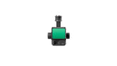

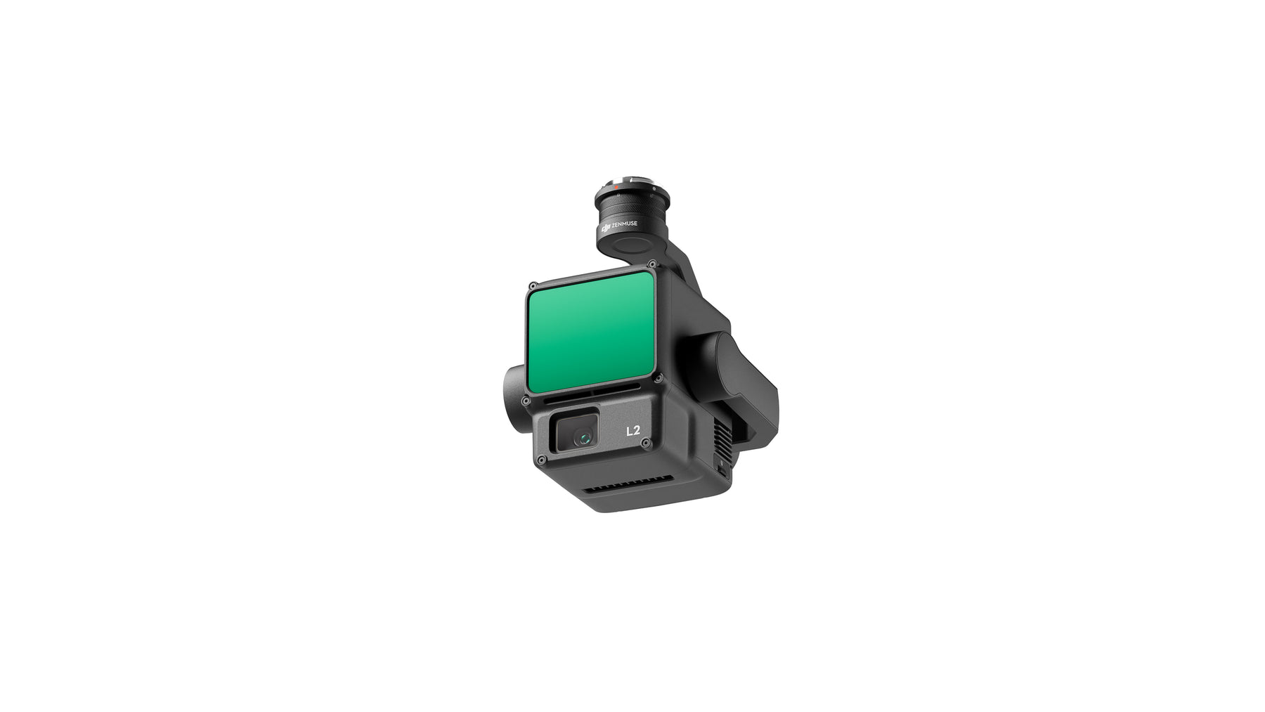
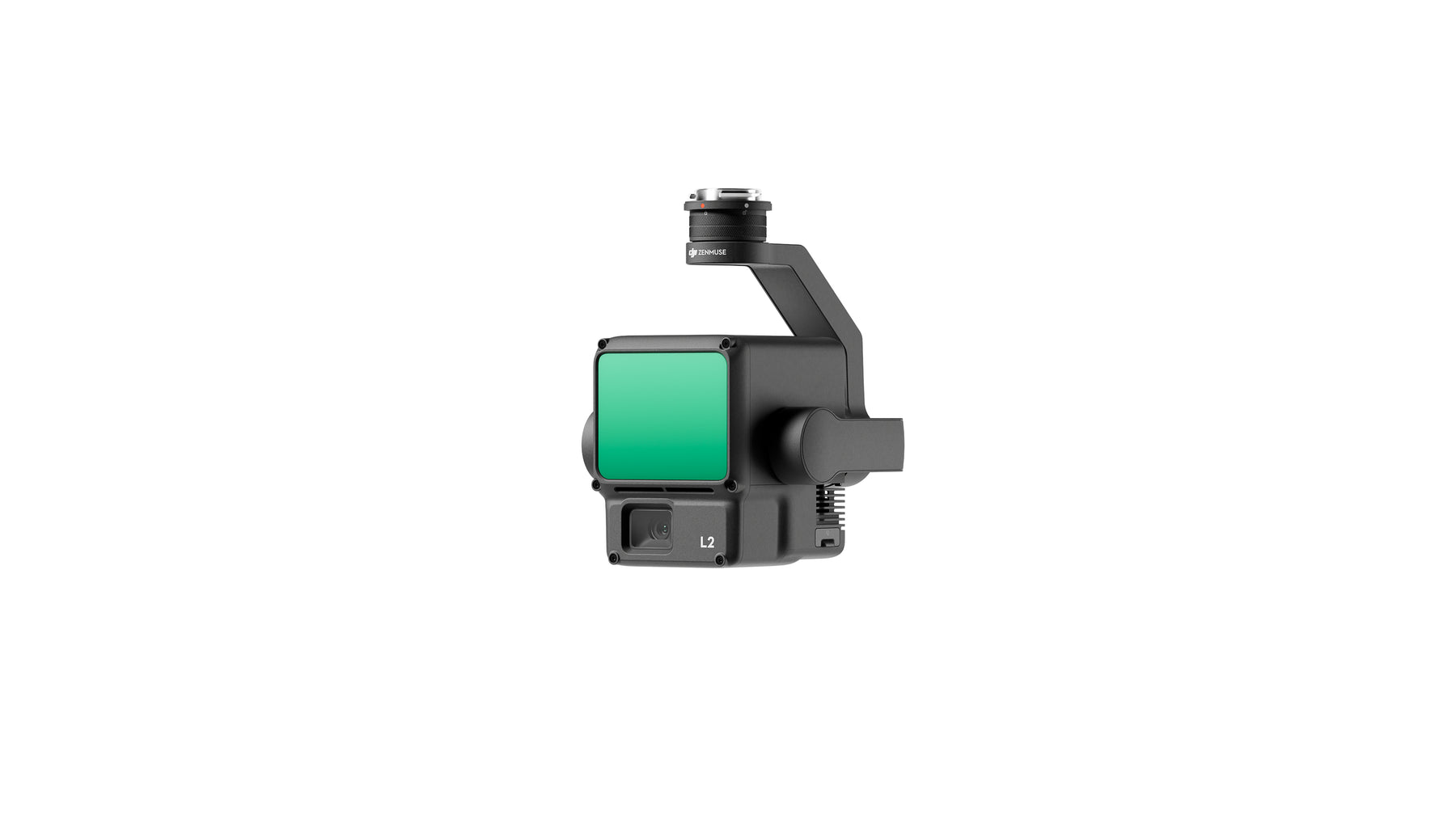
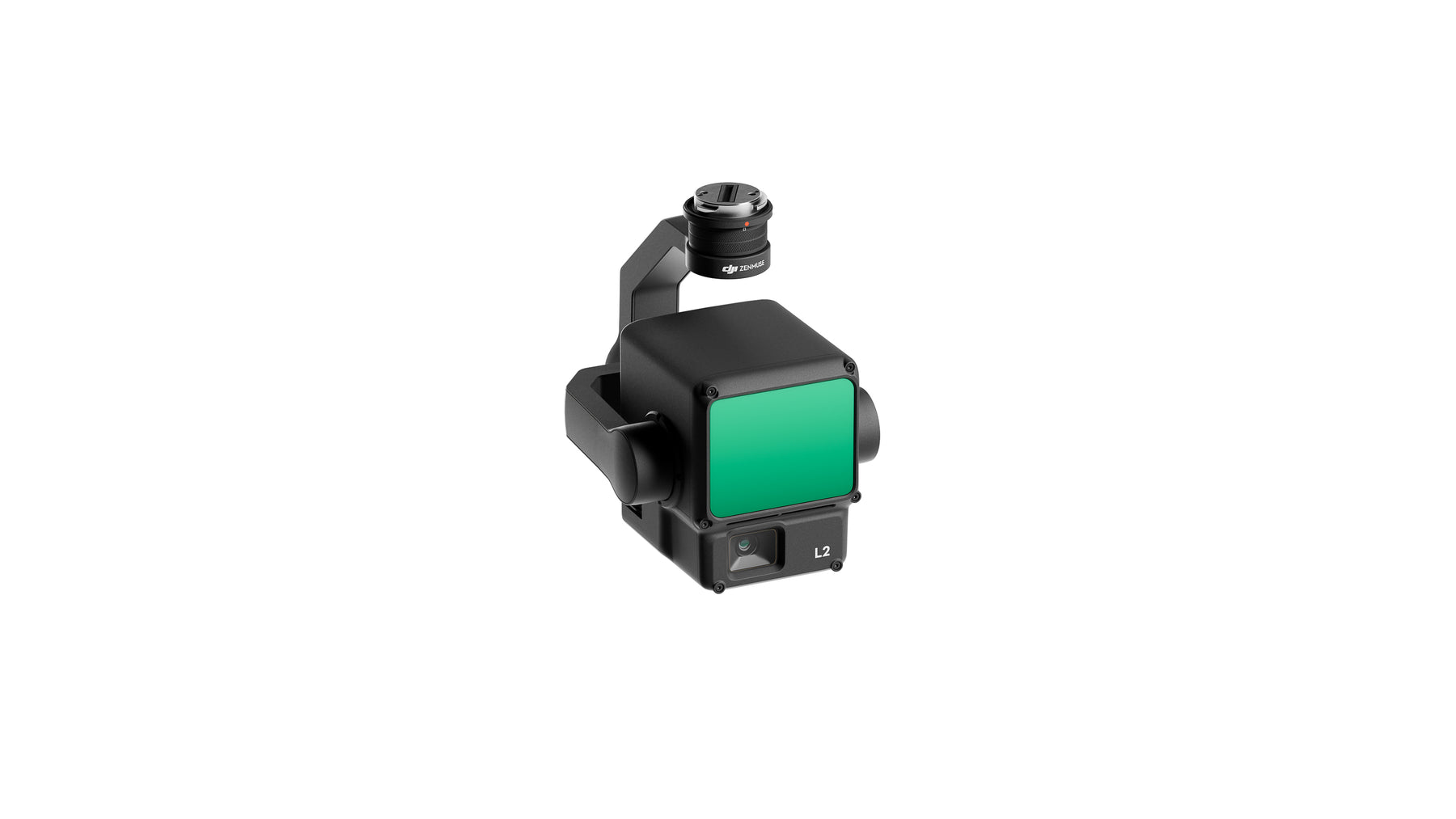
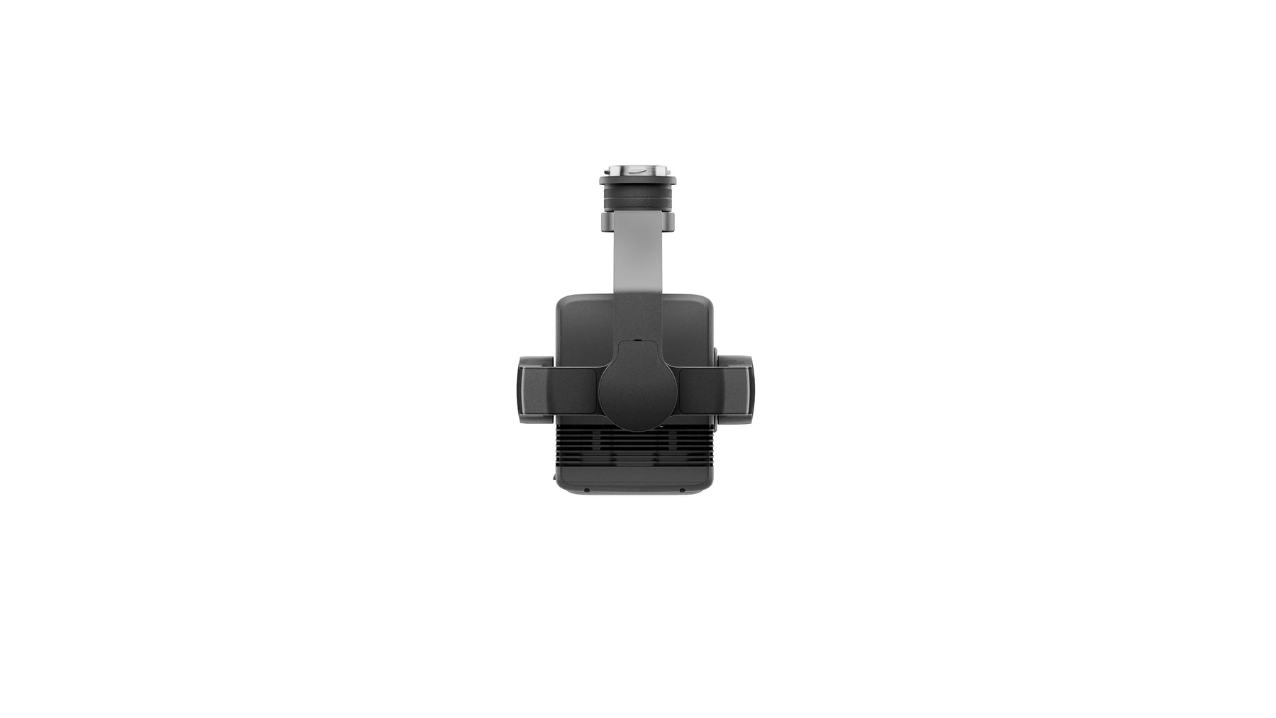
Zenmuse L2
The Zenmuse L2 integrates LiDAR, a high-precision IMU system developed by DJI and a 4/3 RGB CMOS mapping camera, providing DJI flight platforms with more precise, efficient and reliable geospatial data acquisition. Used with DJI Terra, it provides a turnkey solution for high-precision 3D data collection and post-processing.
Matrice 350 RTK Compatibility
Matrix 300 RTK
To use the L2 with the M300 RTK, it is imperative to use the DJI RC Plus, which must be purchased separately, and to perform a firmware update. It is important to note that the L2 is not compatible with the M300 RTK's standard remote control, the Smart Controller Enterprise.
30% increase in detection range.
The L2 can detect from 250 meters with 10% reflectivity and 100 klx, and up to 450 meters with 50% reflectivity and 0 klx. Typical operational altitude now extends to 120 meters, significantly improving operational safety and efficiency.
Smaller laser spots, denser point clouds.
With a reduced spot size of 4x12cm at 100m, only a fifth of that of L1, L2 not only detects smaller objects with greater detail, but can also penetrate denser vegetation, generating more accurate digital elevation models (DEMs).
Support for 5 returns.
In areas with heavy vegetation, L2 can capture more ground points under the foliage.
Effective point cloud rate: 240,000 pts/s.
In single or multiple return mode, the L2 can achieve a maximum point cloud emission rate of 240,000 points per second, allowing more point cloud data to be acquired in a given period of time.
Two scanning modes.
The L2 supports two scanning modes, providing users flexibility depending on their task requirements. In repetitive scanning mode, the L2's LiDAR can produce more uniform and accurate point clouds while meeting high-precision mapping requirements. In non-repetitive scanning mode, it provides deeper penetration to obtain more structural information, making it suitable for power line inspection, forestry surveying and other scenarios.
Improved precision.
The high-precision self-developed IMU system, combined with the drone's RTK positioning system for data fusion in post-processing, allows the L2 to access high-precision absolute position, velocity and attitude information. precision. Additionally, the increased environmental adaptability of the IMU system improves the operational reliability and accuracy of the L2.
Yaw accuracy [6]
Real time: 0.2°, post-processing: 0.05°
Pitch and roll accuracy [6]
Real time: 0.05°, post-processing: 0.025°.
No warming up of the IMU.
The performance of the IMU system has been significantly improved and it is ready for use as soon as it is powered on. Additionally, the accompanying drone is ready to begin its tasks as soon as the RTK is in FIX state, helping to optimize the field experience.
CMOS 4/3, mechanical shutter.
Pixel size has been enlarged to 3.3 μm, and effective pixels now reach 20 MP, resulting in a significant improvement in overall imaging, as well as more enriched true-color point cloud details . The minimum interval between photos has been reduced to 0.7 seconds. The mapping camera can be used up to 200,000 times, further reducing operating costs. When point cloud collection is not needed, the RGB camera can still take photos and videos, or collect images for visible light mapping.

General
Product Name
- Zenmuse L2
Dimensions
- 155×128×176 mm (L×W×H)
Weight
- 905±5g
Power
- 28W (typical) 58W (max.)
IP Rating
- IP54
Supported Aircraft
- Matrice 300 RTK (requires DJI RC Plus) Matrix 350 RTK
Storage Temperature
- -20° to 60° C (-4° to 140° F)
System Performance
Detection Range
- 450m @50% reflectivity, 0 klx 250m @10% reflectivity, 100 klx Typical data. Measured using a flat subject with a size larger than the laser beam diameter, perpendicular angle of incidence, and an atmospheric visibility of 23 km. In low-light environments, the laser beams can achieve the optimal detection range. If a laser beam hits more than one subject, the total laser transmitter power is split, and the achievable range is reduced. The maximum detection range is 500 m.
Point Cloud Rate
- Single return: max. 240,000 pts/s Multiple returns: max. 1,200,000 pts/s
System Accuracy
- Horizontal: 5 cm @ 150 m Vertical: 4 cm @ 150 m Measured under the following conditions in a DJI laboratory environment: Zenmuse L2 mounted on a Matrice 350 RTK and powered up. Using DJI Pilot 2’s Area Route to plan the flight route (with Calibrate IMU enabled). Using repetitive scanning with the RTK in the FIX status. The relative altitude was set to 150 m, flight speed to 15 m/s, gimbal pitch to -90°, and each straight segment of the flight route was less than 1500 m. The field contained objects with obvious angular features, and used exposed hard ground check points that conformed to the diffuse reflection model. DJI Terra was used for post-processing with Optimize Point Cloud Accuracy enabled. Under the same conditions with Optimize Point Cloud Accuracy not enabled, the vertical accuracy is 4 cm and the horizontal accuracy is 8 cm.
Real-Time Point Cloud Coloring Coding
- Reflectivity, Height, Distance, RGB
LiDAR
Ranging Accuracy (RMS 1σ)
- 2cm @ 150m Measured in an environment of 25° C (77° F) with a subject of 80% reflectivity at a distance of 150 m. The actual environment may differ from the testing environment. The figure listed is for reference only.
Maximum Returns Supported
- 5
Scanning Modes
- Non-repetitive scanning pattern, Repetitive scanning pattern
FOV
- Repetitive scanning pattern: Horizontal 70°, Vertical 3° Non-repetitive scanning pattern: Horizontal 70°, Vertical 75°
Minimum Detection Range
- 3m
Laser Beam Divergence
- Horizontal 0.2 mrad, Vertical 0.6 mrad Measured at full width at half maximum (FWHM) conditions. 0.6 mrad means that for every 100m increase in distance, the diameter of the laser beam expands by 6 cm.
Laser Wavelength
- 905nm
Laser Spot Size
- Horizontal 4 cm, vertical 12 cm @ 100 m (FWHM)
Laser Pulse Emission Frequency
- 240kHz
Laser Safety
- Class 1 (IEC 60825-1:2014)
Accessible Emission Limit (AEL)
- 233.59 nJ
Reference Aperture
- Effective Aperture: 23.85 mm (equivalent to circular)
Max Laser Pulse Emission Power Within 5 Nanoseconds
- 46,718W
Inertial Navigation System
IMU Update Frequency
- 200Hz
Accelerometer Range
- ±6g
Angular Velocity Meter Range
- ±300 dps
Yaw Accuracy (RMS 1σ)
- Real-time: 0.2°, Post-processing: 0.05° Measured under the following conditions in a DJI laboratory environment: Zenmuse L2 mounted on a Matrice 350 RTK and powered up. Using DJI Pilot 2’s Area Route to plan the flight route (with Calibrate IMU enabled). RTK in the FIX status. The relative altitude was set to 150 m, flight speed to 15 m/s, gimbal pitch to -90°, and each straight segment of the flight route was less than 1500 m.
Pitch/Roll Accuracy (RMS 1σ)
- Real-time: 0.05°, Post-processing: 0.025° Measured under the following conditions in a DJI laboratory environment: Zenmuse L2 mounted on a Matrice 350 RTK and powered up. Using DJI Pilot 2’s Area Route to plan the flight route (with Calibrate IMU enabled). RTK in the FIX status. The relative altitude was set to 150 m, flight speed to 15 m/s, gimbal pitch to -90°, and each straight segment of the flight route was less than 1500 m.
Horizontal Positioning Accuracy
- RTK FIX: 1 cm + 1 ppm
Vertical Positioning Accuracy
- RTK FIX: 1.5 cm + 1 ppm
RGB Mapping Camera
Sensor
- 4/3 CMOS, Effective Pixels: 20 MP
Lens
- FOV: 84° Equivalent format: 24 mm Aperture: f/2.8-f/11 Focus Points: 1 m to ∞ (with autofocus)
Shutter Speed
- Mechanical Shutter: 2-1/2000 sec Electronic Shutter: 2-1/8000 sec
Shutter Count
- 200000
Photo Size
- 5280×3956 (4:3)
Still Photography Modes
- Single shot: 20 MP Timed: 20 MP JPEG Timed Interval: 0.7/1/2/3/5/7/10/15/20/30/60s RAW/JPEG + RAW Timed Interval: 2/3/5/7/10/15/20/30/60 s
Video Codec and Resolution
- H.264 4K: 3840×2160@30fps FHD: 1920×1080 @30fps
ISO
- Video: 100-6400 Photo: 100-6400
Video Bitrate
- 4K: 85Mbps FHD: 30Mbps
Supported File System
- exFAT
Photo Format
- JPEG/DNG (RAW)
Video Format
- MP4 (MPEG-4 AVC/H.264)
Gimbal
Stabilization System
- 3-axis (tilt, roll, pan)
Angular Vibration Range
- 0.01°
Mounting
- Detachable DJI SKYPORT
Mechanical Range
- Tilt: -143° to +43° Pan: ±105° * Structural limit, not controllable range.
Controllable Range
- Tilt: -120° to +30° Pan: ±90°
Operation Mode
- Follow/Free/Re-center
Data Storage
Raw Data Storage
- Photo/IMU/Point cloud/GNSS/Calibration files
Point Cloud Data Storage
- Real-time modeling data storage
Supported microSD Cards
- microSD: Sequential writing speed 50 MB/s or above and UHS-I Speed Grade 3 rating or above; Maximum capacity: 256 GB. Use the recommended microSD cards.
Recommended microSD Cards
- Lexar 1066x 64GB U3 A2 V30 microSDXC Lexar 1066x 128GB U3 A2 V30 microSDXC Kingston Canvas Go! More 128GB U3 A2 V30 microSDXC Lexar 1066x 256GB U3 A2 V30 microSDXC
Post-Processing
Supported Software
- DJI Terra
Data Format
- DJI Terra supports exporting point cloud models in the following formats: PNTS/LAS/PLY/PCD/S3MB

What is the level of protection of the Zenmuse L2?
The Zenmuse L2 achieves an IP54 protection level according to IEC60529 under controlled laboratory conditions. To ensure the highest levels of protection:
- Before installation, make sure the interface and ball joint surface are dry;
- Before use, make sure the ball head is firmly installed on the drone and the SD card protective cap is clean, free of any foreign objects and closed;
- Before opening the SD card protective cap, wipe the surface of the drone.
The level of protection decreases over time due to normal use and wear of the device.
Which aircraft is the Zenmuse L2 compatible with? Which gimbal interface can it be mounted on?
The Zenmuse L2 is compatible with the Matrice 350 RTK and Matrice 300 RTK and only supports the DJI RC Plus remote control. Before using, please update the firmware of the device and remote control to the latest version. To ensure mapping accuracy, ensure the L2 is mounted on a single gimbal connector facing down with the cable connected to the right USB-C port (when facing the aircraft).
What is the field of view (FOV) of the Zenmuse L2 LiDAR?
Repeat scanning: Horizontal 70°, Vertical 3°.
Non-repetitive scanning: Horizontal 70°, Vertical 75°.
What is the maximum detection range of the Zenmuse L2?
Detection range:
250 m at 10% reflectivity, 100 klx
450 m at 50% reflectivity, 0 klx
Recommended operating altitude is 30 to 150 m.
How many returns does Zenmuse L2 support?
The Zenmuse L2 supports five types of returns: Single return (loudest echo), double return, triple return, quadruple return and penta return.
What is the point cloud rate of Zenmuse L2??
Single return: max. 240,000 pts/s
Multiple returns: max. 1,200,000 pts/s.
How many scan modes does the Zenmuse L2 have? In what scenarios do they apply?
The Zenmuse L2 has two scanning modes: non-repeating scanning mode and repeating scanning mode
In repetitive scanning mode, LiDAR can achieve more uniform and precise scanning, meeting the requirements of high-precision mapping.
In non-repetitive scanning mode, it provides greater penetration and can collect more structural information, making it suitable for power line inspection, forestry surveying and other scenarios.
How accurate is the Zenmuse L2 IMU?
Yaw accuracy: Real time: 0.2°, post-processing: 0.05°
Pitch and roll accuracy: Real-time: 0.05°, post-processing: 0.025°.
Horizontal positioning accuracy: 1 cm + 1 ppm (RTK FIX)
Vertical positioning accuracy: 1.5 cm+1 ppm (RTK FIX)
Yaw and pitch/roll accuracies were measured under the following conditions in a DJI laboratory environment: Zenmuse L2 mounted on a Matrice 350 RTK and powered on. Using DJI Pilot 2's Area Route to plan the flight route (with Calibrate IMU enabled). RTK in FIX status. The relative altitude was set to 150 m, the flight speed to 15 m/s, the gimbal pitch to -90°, and each straight segment of the flight route was less than 1500 m.
What is the L2 RGB camera used for?
When collecting point cloud data, the RGB camera can provide real-time color information for the data, and the photos taken can be used to reconstruct 2D RGB models. When there is no need to collect point cloud data, the RGB camera can take photos and videos, and collect images to reconstruct 2D or 3D RGB models.
How accurate is the Zenmuse L2 surveying and mapping?
Horizontal accuracy: 5 cm
Vertical accuracy: 4 cm
Measured under the following conditions in a DJI laboratory environment: Zenmuse L2 mounted on a Matrice 350 RTK and powered on. Using DJI Pilot 2's Zone Route to plan the flight route (with Calibrate IMU enabled). Using a repetitive scan with the RTK in FIX state. The relative altitude was set to 150 m, the flight speed to 15 m/s, the gimbal pitch to -90°, and each straight segment of the flight route was less than 1500 m. The field contained objects with obvious angular features, and used control points of exposed hard ground that conformed to the diffuse reflection model. DJI Terra was used for post-processing with the Optimize Point Cloud Accuracy option. Under the same conditions, if the Optimize point cloud precision option is not activated, the vertical precision is 4 cm and the horizontal precision is 8 cm.
What is the CMOS size of the Zenmuse L2 RGB camera? And what is the size of its pixels?
The RGB camera uses 4/3 CMOS and the pixel size is 3.3 × 3.3 μm.
What are the improvements made to the Zenmuse L2 compared to the previous generation?
LiDAR performance has been improved to approximately 1/5 of the spot size of L1 when the object or area is 100m from the LiDAR. The penetrating ability of LiDAR has been significantly improved, as has its detection range and accuracy. The pixel size of the RGB camera has increased by 89% compared to L1's 2.4 × 2.4μm. IMU accuracy has been improved to 0.05° (real-time) and 0.025° (post-processing). LiDAR supports laser range finder (RNG).
Recommended with this product
Shipped in 24-48hrs
Free delivery and shipped within 24/48 hours on all orders over $149 in Canada.
Secure payments
Order without fear thanks to secure payment by credit card or PayPal.
You have questions?
Enjoy a fast and certified support from our technicians.