
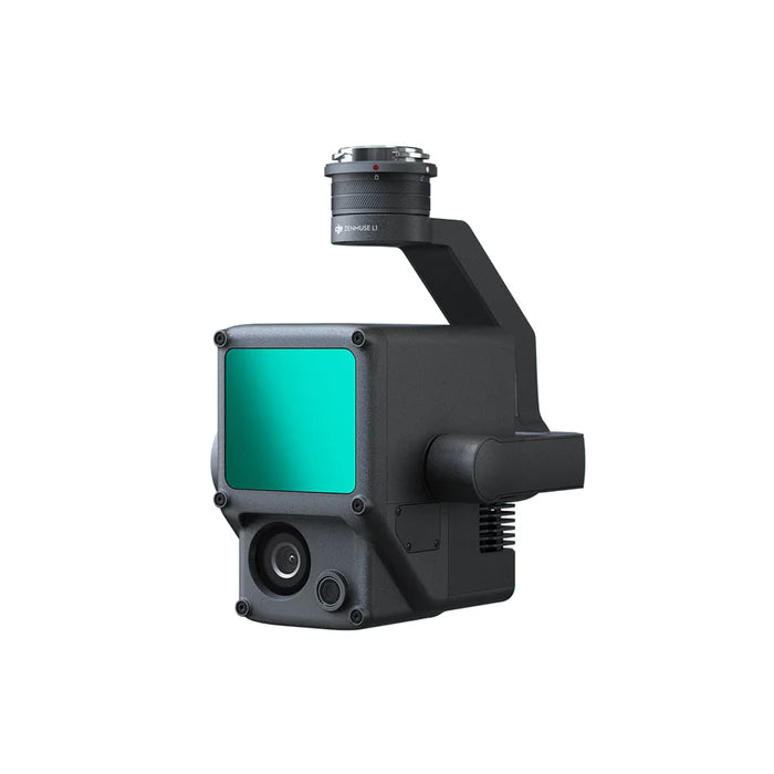
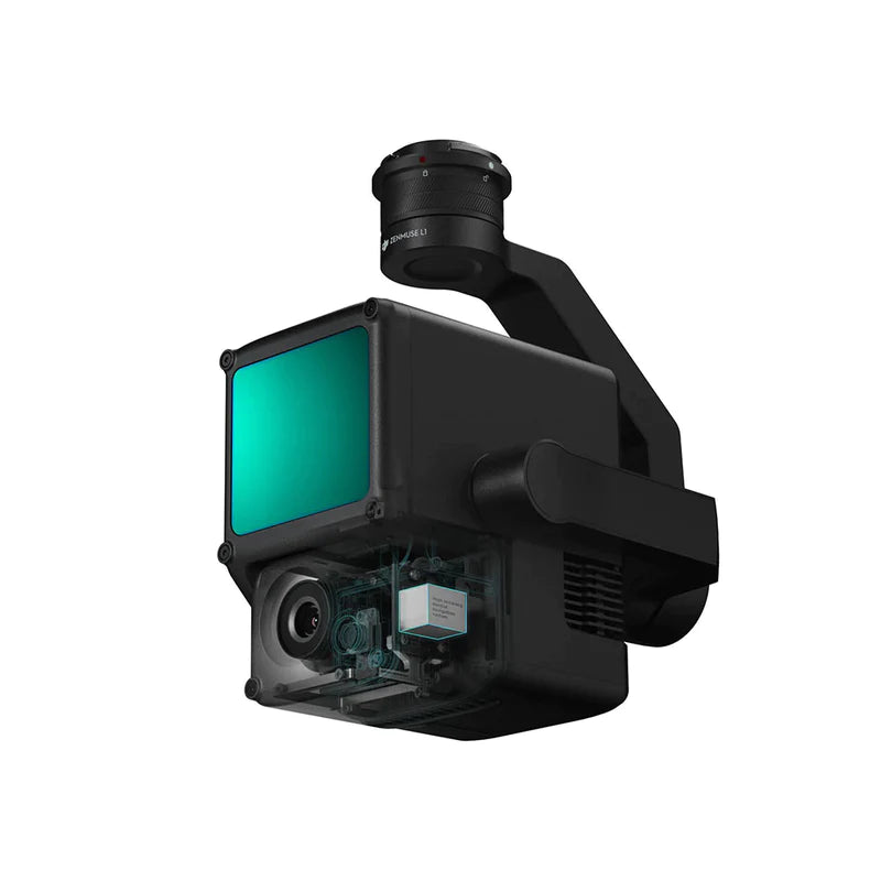
DJI Zenmuse L1
A Lidar + RGB solution for aerial surveys
- Integrates a module Lidar, an RGB camera and a high-precision IMU.
- High efficiency 2 km2 covered in a single flight.
- High accuracy : Vertical accuracy: 5 cm. Horizontal accuracy: 10 cm.
- Point rate: 240 000 pts/s
- Supports 3 returns
- Detection range : 450 m (80% reflectivity, 0 klx)
- Ingress protection level IP54
Scan without compromise
Outstanding efficiency
Generate color point cloud models in real time, or acquire 2 km2 of point cloud data in a single flight using the Livox frame Lidar module with a 70° FOV and a visible light camera with a sensor of 1 inch.
Unparalleled precision
Perform centimeter-wide reconstructions with high-precision IMU, positioning accuracy sensor and GNSS data embedding.
Ready when you are
The IP54 standard allows the L1 to be used in rainy or foggy environments. The active scanning method of the Lidar module allows you to fly at night.
Visualize data while you fly with the Livox Lidar module
- Frame lidar with up to 100% efficient point cloud results.
- Detection range: 450m (80% reflectivity, 0 klx) / 190 m (10% reflectivity, 100 klx)
- Effective point rate: 240,000 pts/s
- Support of 3 returns.
- Non-repeating scan pattern, repeating scan pattern
Everything in view with the RGB camera
- 20MP
- 1 inch CMOS
- Mechanical shutter
Precise details at your disposal thanks to the high-precision IMU
- Vision sensor for positioning accuracy
- Merging GNSS, IMU and RGB data
Recreate the world in 3D point clouds
Real-time point cloud
Real-time point clouds provide immediate insight into the field, so operators are informed to make critical decisions quickly. You can also verify the quality of the work in the field by checking the point cloud data immediately after each flight.
Measurements and annotations
Acquire and communicate critical dimensions on the point cloud model using measurements and annotations.
A one-stop-shop for post-processing
DJI Terra fuses IMU and GNSS data for point cloud and visible light calculations, in addition to performing POS data calculations so you can effortlessly generate reconstructed models and accuracy reports.
Application scenarios
Topographic mapping
Quickly create topographic maps using accurate digital elevation models.
Civil engineering, construction and surveying
Manage the entire project lifecycle using highly accurate point clouds and 3D models.
Emergency Response and Public Safety
At any time of day, gather critical information in real time using true color point clouds. Get real-time situational awareness and forensic information to make informed decisions on the spot.
Energy and infrastructure
Model sparse or complex structures in detail to manage them efficiently and safely.
Agricultural and forestry management
Get insight into vegetation density, area, stock volume, canopy width and growth trends.
General settings
Product Name
- Zenmuse L1
Dimensions
- 152 x 110 x 169 mm
Weight
- 930±10 g
Power
- Classic: 30W; max: 60W
Protection sign
- IP54
Compatible devices
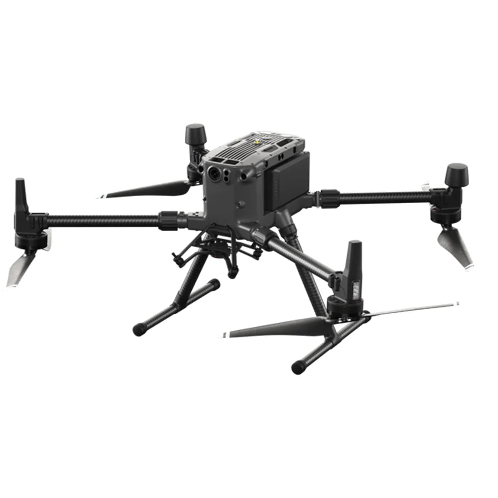
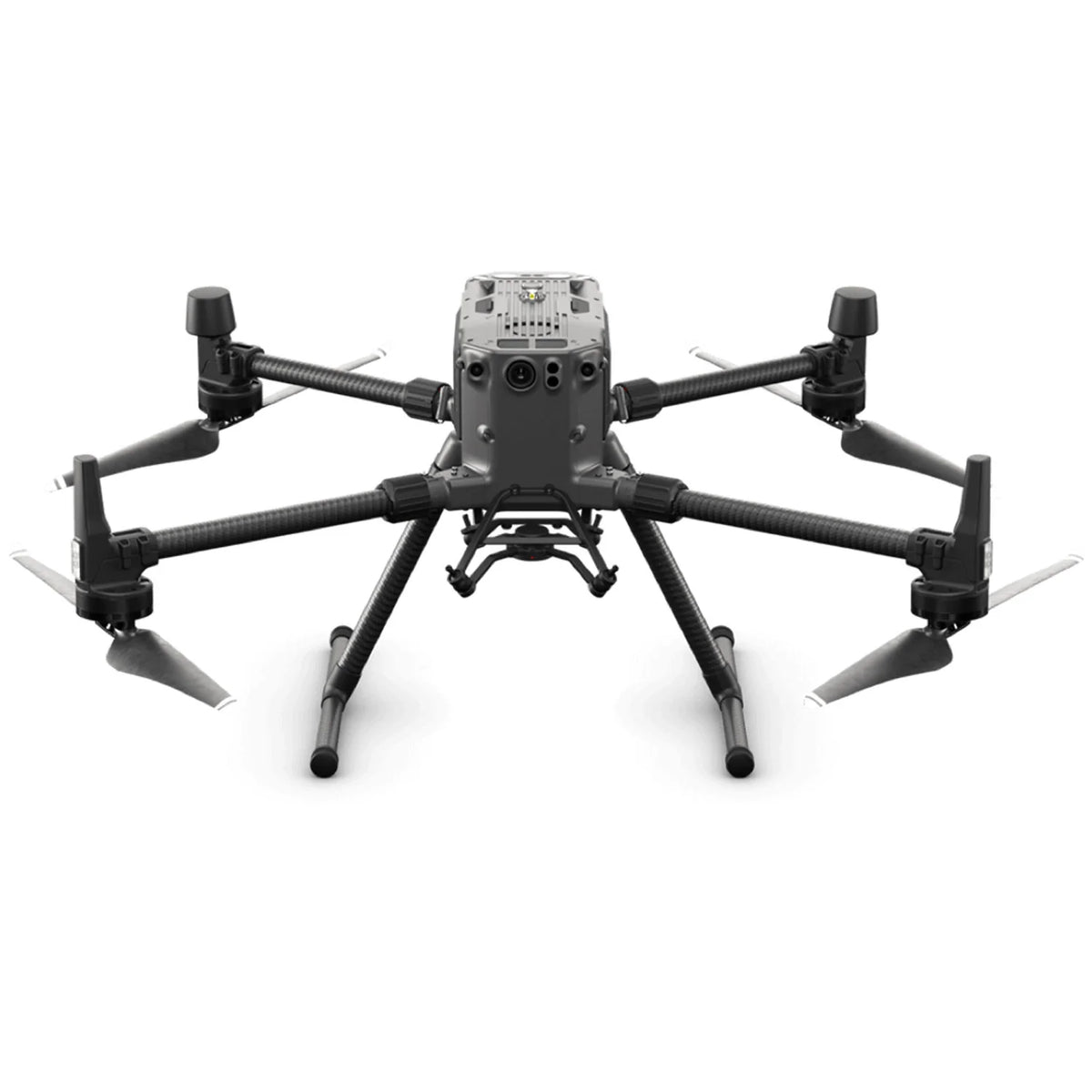
- Matrice 300 RTK
Operating temperature range
- -20 ° C to 50 ° C (-4 ° F to 122 ° F)
0°C to 50°C (32°F to 122°F)(when using an RGB mapping camera)
Storage temperature range
- -20 ° C to 60 ° C (-4 ° F to 140 ° F)
System Performance
Detection range
- 450 m at 80% reflectivity, 0 klx;
190 m at 10% reflectivity, 100 klx
Real-time point cloud coloring modes
- True colors; coloring by reflectivity; elevation staining; coloring by distance
System Performance
Number of points
- Single Return: Max. 240,000 pts/s;
multiple return: max. 480,000 dots/s
System Accuracy(RMS 1σ)1
- Horizontal: 10cm @ 50m;
Vertical: 5 cm to 50 m
To lead
Telemetry Accuracy2
- 3cm at 100m
Maximum number of returns supported
- 3
Scan Modes
- Non-repeating sweep pattern, repeating sweep pattern
Field of view
- Non-repeating scanning pattern: 70.4° (horizontal) × 77.2° (vertical);
Repeating scan pattern: 70.4° (horizontal) × 4.5° (vertical)
Laser safety index
- Class 1 (IEC 60825-1:2014) (Ocular safety)
Inertial navigation system
IMU refresh rate
- 200 Hz
Accelerometer range
- ±8 g
Angular Velocity Measurement Range
- ±2000 dps
Yaw Accuracy(RMS 1σ)
- Real-time: 0.3°, Post-processing: 0.15°
Accuracy of vertical tilt and roll (RMS 1σ) 1
- Real-time: 0.05°, Post-processing: 0.025°
Auxiliary positioning vision sensor
Definition
- 1280×960
Field of view
- 95°
RGB mapping camera
Sensor size
- 1 inch
Effective Pixels
- 20 MP
Ratio Photo
- 5472×3078 (16:9); 4864×3648 (4:3); 5472×3648 (3:2)
Focal distance
- 8.8mm / 24mm (Equivalent)
Shutter speed
- Mechanical Shutter Speed: 1/2000 - 8s
electronic shutter speed: 1/8000 - 8 sec
MAJOR
- Video: 100 – 3200 (Auto), 100 – 6400 (Manual)
Photo: 100 - 3200 (Auto), 100 - 12800 (Manual)
Aperture range
- f/2.8 - f/11
System File Supported
- FAT (≤32 GB); exFAT (>32 GB)
Picture format
- JPEG
Video format
- MOV, MP4
Video resolution
- H.264, 4K: 3840×2160 30p
Carrycot
Stabilized system
- 3-axis (tilt, roll, pan)
Angular vibration range
- 0.01°
Support
- Detachable DJI SKYPORT
Mechanical range
- Tilt: -120° to +30°; Pan: ±320°
Operating modes
- Track/Free/Refocus
Data storage
Raw data storage
- Photo/IMU/GNSS Files/Point Cloud/Calibration Data Storage
Supported microSD cards
- microSD: 50MB/s or better sequential write speed and UHS-I class 3 or better; maximum capacity: 256 GB
Recommended microSD cards
- SanDisk Extreme 128GB UHS-I Speed Grade 3
SanDisk Extreme 64GB UHS-I Speed Grade 3
SanDisk Extreme 32GB UHS-I Speed Grade 3
SanDisk Extreme 16GB UHS-I Speed Grade 3
Lexar 1066x 128GB U3
Samsung EVO Plus 128GB
Post-processing software
Supported Software
- DJI Earth
Data format
- DJI Terra supports exporting point cloud models in the standard format:
Point cloud format: PNTS/LAS/PLY/PCD/S3MBity) at 100 meters. The result may vary depending on the different conditions of your
What is the level of protection of the Zenmuse L1?
The Zenmuse L1 has an IP54 rating under the IEC60529 standard. This means that it is protected against solid objects larger than 1 mm and against splashing water from all directions. However, the level of protection is not permanent and will decrease over time as the device wears.
To ensure the highest levels of protection:
- Before installation, make sure the interface and surface of the gimbal are dry;
- Before use, make sure the gimbal is firmly installed on the drone and the SD card protection cap is clean, free of foreign objects and closed;
- Before opening the SD card protection cap, wipe the surface of the drone.
What devices is the L1 compatible with?
The L1 is compatible with the M300 RTK. Before using it, please update the firmware of the drone and the remote control to the latest version.
What applications are compatible with the L1?
The L1 is currently only compatible with the Android version of the DJI Pilot app.
Does the camera require an SD card?
The camera requires a MicroSD card with a Class 10 or higher transmission rate or a UHS-1 card, with a maximum capacity of 256 GB.
What is the field of view (FOV) of the L1 Lidar?
In non-repeating scan mode, the field of view is 70.4°x77.2°.
In repetitive scan mode, the field of view is 70.4°x4.5°.
What is the maximum measuring range of the L1?
The maximum range of the L1 is 190m@10%, 100klx; 450m@80%, 0klx.
Typical recommended working height is 50-120m.
What is the sweep frequency of the L1?
The L1 offers three sweep rates: one/two returns: 80K/s, 160K/s and 240K/s; three returns: 80K/s, 240K/s.
How many scan modes does the L1 have?
The L1 has two scan modes: Non-repeating scan mode and repeat scan mode.
How many returns does the L1 support?
The L1 supports 3 types of returns:
- A return ;
- Two returns;
- Three returns.
What does the Point Cloud LiveView feature of the L1 do?
The L1 collects point cloud models based on RTK technology and displays the collected models on Pilot in real time.
The following features are supported:
- Rotate, slide, zoom, quick change of perspectives and centering;
- Multiple coloring modes including RGB, reflectivity, elevation, and distance;
How does the L1 achieve high-precision post-processing modeling?
For high-precision post-processing modeling, you can import SD card data into DJI Terra with one click. This will result in a colorized point cloud model with high precision PPK-IMU position and orientation calculation.
What model reconstruction formats does the L1 support?
The L1 supports the following model reconstruction formats: Point cloud formats: PNTS, LAS, PLY, PCD and S3MB.
What types of flight missions does the L1 support?
The L1 currently supports mapping, line flight, oblique flight, and waypoint missions.
How accurate is the L1 IMU?
In typical operating scenarios, the L1's IMU accuracy is 0.025° (roll/pitch) / 0.15° (yaw). Accuracy was measured under the following conditions in a DJI lab environment: after a 5-minute warm-up, using Mapping Mission with Calibration Flight enabled in DJI Pilot, and with RTK in FIX status. The relative altitude was set to 50 m, the flight speed to 10 m/s, the gimbal tilt to -90°, and each straight segment of the flight path was less than 1000 m. DJI Terra was used for post-processing.
What does the L1's auxiliary vision sensor do?
The vision sensor provides altitude data. This means that in the event of a temporary failure of the GNSS signal, the accuracy of the device will not be affected for a period of up to 60 seconds. Support to come.
What is the L1's RGB camera for?
The L1's RGB camera offers basic functions for taking photos and recording videos and provides real-time color information for point cloud data during the scanning process. This allows the L1 to produce true color point clouds and reality models.
Note that Lidar scanning and video recording cannot work simultaneously.
How accurate is the L1 surveying and mapping?
The vertical accuracy of the L1 can reach 5cm and the horizontal accuracy can reach 10cm. Accuracy was measured under the following conditions in a DJI lab environment: after a 5-minute warm-up, using the mapping mission with calibration flight enabled in DJI Pilot, and with the RTK in FIX status. The relative altitude was set to 50m, the flight speed to 10m/s, the gimbal tilt to -90°, and each straight segment of the flight path was less than 1000m. DJI Terra was used for post-processing.
Can the L1 work at night?
The L1's Lidar module has an active sensing capability that can scan the terrain to collect point clouds at night or in other low light conditions.
What scanning mode does the L1 Lidar module adopt?
The L1's lidar module adopts an advanced frame scan mode. This ensures that all point clouds collected are valid point cloud data.
How efficient are L1 surveying and mapping operations?
At a flight height of 100m and a speed of 13m/s, a single flight with the M300 RTK and L1 can collect data covering an area of 2 km2.
What are the application scenarios of the Zenmuse L1?
The L1 can be widely used in multiple scenarios, including:
- Topographic survey and cartography
- Modeling Power Line Corridors
- Emergency Response Surveys and Mapping
- Detailed modeling
- Agricultural and forestry investigation
Which M300 RTK gimbal can the L1 be mounted on?
The L1 can be mounted on the lower right turret port (when facing the drone) of the M300 RTK. Currently, it only supports one gimbal mode.
Recommended with this product
Shipped in 24-48hrs
Free delivery and shipped within 24/48 hours on all orders over $149 in Canada.
Secure payments
Order without fear thanks to secure payment by credit card or PayPal.
You have questions?
Enjoy a fast and certified support from our technicians.