
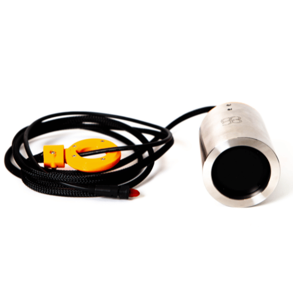
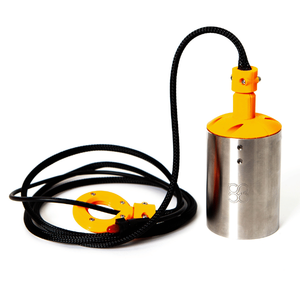
SPH – Echologger ECT D052 dual-frequency for unmanned aerial vehicle
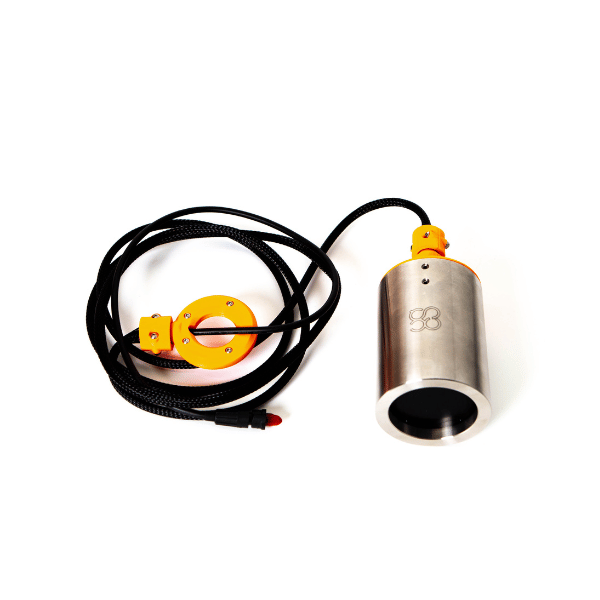
Dual-frequency depth sounder ECT D052 optimized for great depths, designed to be hung under a drone. It includes tilt and temperature sensors, a sturdy RS232 transmission, and works with SkyHub and major hydrographic software.
Deep bathymetry by drone
The ECT D052 is part of SPH Engineering’s integrated drone bathymetry system. It effectively replaces traditional boat-mounted solutions by allowing:
-
Access to areas difficult or costly to reach by boat
-
Quick deployment and simplified logistics
-
Accurate tracking of programmed survey lines
-
Use in varied environments (lakes, rivers, reservoirs, calm coastal zones)
Dual-frequency sensor aimed at “great depth”
-
Dual-frequency: 50 kHz / 200 kHz, ideal for deeper measurements and variable water conditions.
-
Nominal accuracy: 0.2% of measured depth
-
Resolution: < 1 mm
-
Built-in tilt and temperature sensors to improve data quality and reliability.
-
RS232 interface ensuring stable data transmission over long cable.
Integration with SkyHub (onboard computer)
The SkyHub provides:
-
Maintaining a constant drone height above the water thanks to a high-frequency radar altimeter (more precise than a barometric altimeter).
-
Recording measurements in georeferenced format.
-
Automatic start of data acquisition upon sensor immersion and stop when it emerges from the water.
-
Real-time transmission of depths to the ground station.
Data formats and software compatibility
Export possible in:
-
CSV (XYZ coordinates + depth + metadata)
-
NMEA 0183 (compatible with standard hydrographic software)
-
SEG-Y (complete raw echo sounder data)
Compatible notably with HydroMagic and Reefmaster, as well as with various GIS and bathymetry tools.
Modes of operation
-
Continuous measurements along survey lines
-
Measurements at defined waypoints
-
Spot manual measurements
| Category | Specification |
| Type | Dual-frequency single-beam echo sounder |
| Acoustic frequencies | 50 kHz / 200 kHz |
| Measurement range (50 kHz) | 1.0 – 200 m |
| Measurement range (200 kHz) | 0.5 – 200 m |
| Beamwidth | 27° (50 kHz) / 7° (200 kHz) |
| Nominal accuracy | 0.2% of depth |
| Resolution | < 1 mm |
| Sounder weight (air) | 460 g |
| Total system weight (lightweight) | 2.7 kg |
| Data interface | RS232 |
| Integrated sensors | Tilt + temperature |
| Onboard computer | SkyHub |
| Altimeter | High-frequency radar |
| Compatible drones (DJI) | M300 RTK, M350 RTK, M600 Pro |
| Pixhawk Support | Yes (drones of comparable size) |
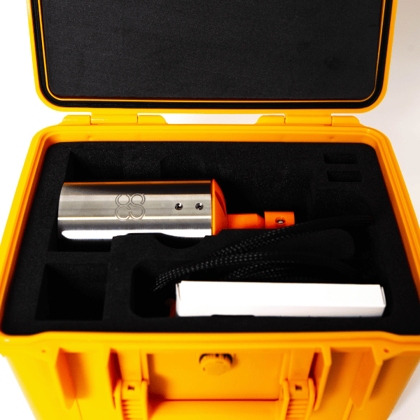
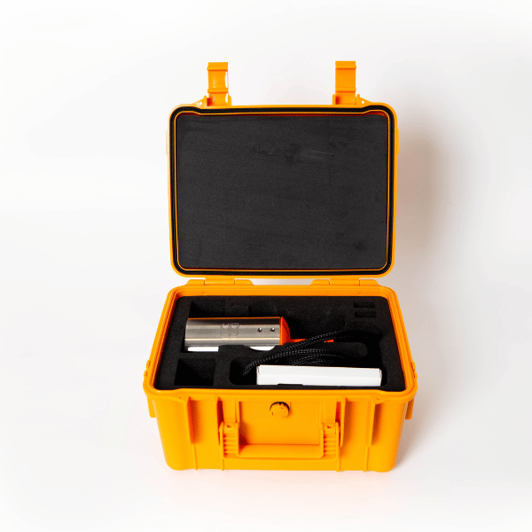
- 1 × Depth sounder ECT D052 (stainless steel case, cable, hook + carabiner)
- 1 × Set of cables
- 1 × Onboard computer SkyHub
- 1 × Radar altimeter + mounting brackets for drone
Recommended with this product
Shipped in 24-48hrs
Free delivery and shipped within 24/48 hours on all orders over $149 in Canada.
Secure payments
Order without fear thanks to secure payment by credit card or PayPal.
You have questions?
Enjoy a fast and certified support from our technicians.