
SPH – Echologger ECT D24 dual-frequency for unmanned aerial vehicle
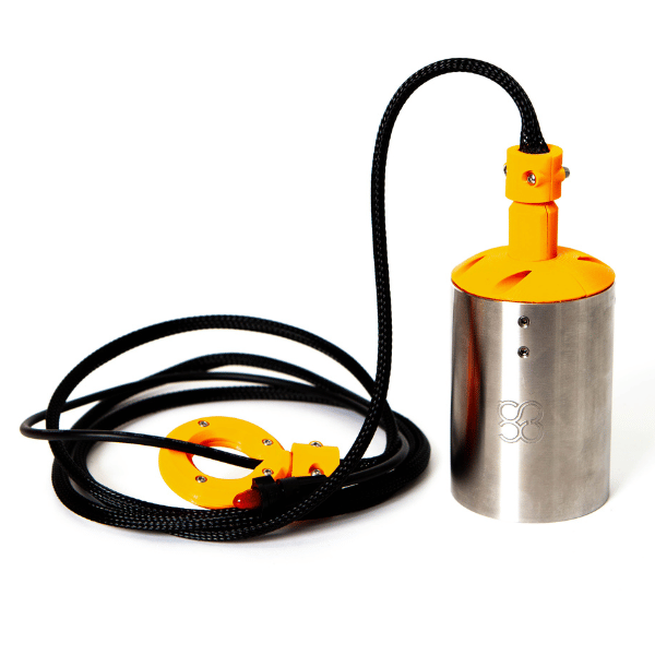
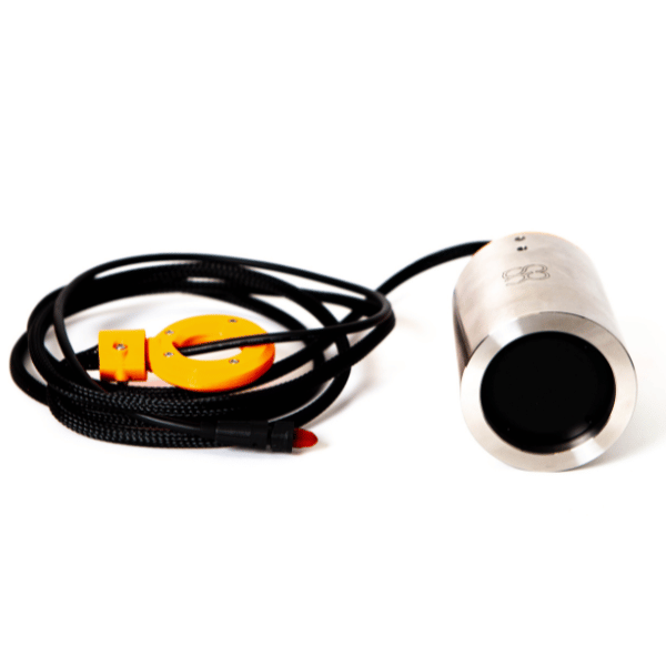
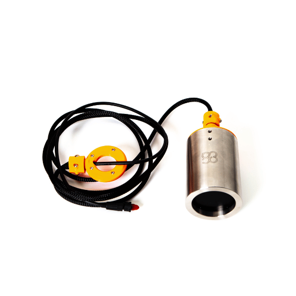
Dual-frequency acoustic depth sounder ECT D24, designed to be hung beneath a drone to carry out precise depth surveys in rivers, lakes, and hard-to-reach areas. Includes tilt and temperature sensors, robust RS232 transmission, and compatibility with SkyHub and standard hydrographic software.
A bathymetric system suited for drones
The ECT D24 is part of the integrated drone bathymetry system developed by SPH Engineering. Instead of using a traditional boat, the sounder is submerged beneath a drone (DJI or Pixhawk), allowing:
-
Access to shallow or hard-to-reach areas
-
Quick and easy deployment
-
Accurate tracking of preplanned survey lines
-
Simplified logistics (transport, deployment, recovery)
High-performance and reliable sensor
-
Dual-frequency technology (200 kHz / 450 kHz) to adapt to different water conditions and depths.
-
Nominal accuracy: 0.2% of the measured depth
-
Resolution: < 1 mm
-
Built-in tilt and temperature sensors, allowing real-time correction and qualification of data.
-
RS232 interface ensuring stable data transmission over long cables.
Integration with SkyHub (onboard computer)
The SkyHub is the heart of the system:
-
Keeps the drone at a constant height above the surface thanks to a high-frequency radar altimeter (much more precise than a barometric altimeter).
-
Records sounder measurements in georeferenced format.
-
Allows automatic acquisition as soon as the sensor is submerged and automatic stop when it comes out of the water.
-
Streams measurements in real time to the ground station for operational control.
Data formats and software compatibility
Data can be exported in:
-
Simple textual CSV (XYZ + depth + metadata)
-
NMEA 0183 (compatible with common hydrographic software)
-
SEG-Y (full raw sounder data)
Compatible with software such as HydroMagic and Reefmaster, as well as many GIS and bathymetric tools.
Operating modes
The system supports three modes:
-
Continuous measurements along survey lines
-
Measurements at defined waypoints
-
Spot manual measurements
Note: The measurement range is calculated from the bottom of the transducer. The practical minimum depth is ~15 cm, as the sensor must be submerged.
| Category | Specification |
| Type | Dual-frequency single-beam echo sounder |
| Acoustic frequencies | 200 kHz / 450 kHz |
| Measurement range (200 kHz) | 0.5 to 200 m |
| Measurement range (450 kHz) | 0.15 to ~100 m |
| Beamwidth | 10° (200 kHz) / 5° (450 kHz) |
| Nominal accuracy | 0.2% of depth |
| Resolution | < 1 mm |
| Sounder weight (air) | 280 g |
| Total system weight (lightweight) | 1.6 kg |
| Total system weight (reinforced case) | 2.6 kg |
| Data interface | RS232 |
| Integrated sensors | Tilt + temperature |
| Onboard computer | SkyHub |
| Altimeter | High-frequency radar |
| Compatible drones (DJI) | M210, M300 RTK, M350 RTK, M600 Pro |
| Pixhawk Support | Yes (drones of comparable size) |
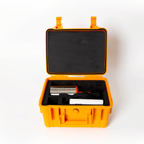
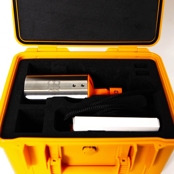
- 1 × Depth sounder ECT D24 (stainless steel case, cable, hook + carabiner)
- 1 × Set of cables
- 1 × Onboard computer SkyHub
- 1 × Radar altimeter + mounting brackets for drone
Shipped in 24-48hrs
Free delivery and shipped within 24/48 hours on all orders over $149 in Canada.
Secure payments
Order without fear thanks to secure payment by credit card or PayPal.
You have questions?
Enjoy a fast and certified support from our technicians.