
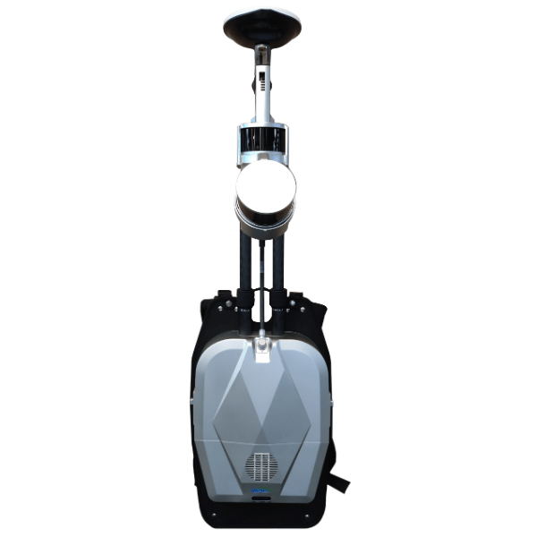
GV LIBACKPACK - DGC50H+ LiDAR360MLS BP Module
High-precision portable LiDAR system with dual sensor, GNSS + SLAM, 5.7K panoramic camera, and integrated LiDAR360MLS post-processing.
The LiBackpack DGC50H is a next-generation mobile LiDAR mapping system, designed to offer an optimal balance between performance, accuracy, and portability. Equipped with two 16-channel laser heads, it generates up to 640,000 points per second with centimeter-level accuracy, even in GNSS-limited environments thanks to the GNSS + SLAM fusion.
The integrated panoramic camera captures images in 5.7K timelapse mode, significantly reducing video size while maintaining exceptional visual quality. Thanks to the LiDAR360MLS software, data can be processed with one click to generate high-density point clouds, panoramic images, plans, and 3D models usable in fields such as BIM, surveying, mining inspection, tunnels, facades, and forestry.
Ergonomic and lightweight (8.6 kg), it allows real-time data collection with immediate export, while covering up to 20,000 m² in 30 minutes, with a battery life of 2.5 hours.
System Settings
| Characteristic | Value |
| Dimensions (closed / open) | 960 × 318 × 315 mm / 1135 × 318 × 315 mm |
| Weight (without battery) | 8,6 kg |
| Consumption | 50 W |
| Internal storage | 512 Go |
| Mode of operation | Portable (backpack) |
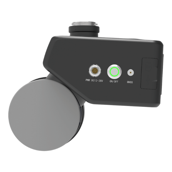
LiDAR sensor
| Setting | Value |
| Number of sensors | 2 |
| Channels | 16 |
| Points rate | 640,000 pts/s (simple return) |
| Number of returns | 2 |
| Scope | Up to 120 m |
| Field of vision | 360° horizontal / 180° vertical |
| Measurement accuracy | ±1 cm |
GNSS
| Characteristic | Details |
| Supported systems | GPS, GLONASS, Galileo, BeiDou |
| Types of signals | GPS: L1 C/A, L1C, L2C, L2P, L5 GLONASS: L1 C/A, L2C, L2P, L3, L5 Galileo: E1, E5a, E5b, E5 Alt BOC, E6 BeiDou: B1, B2 |
| Positioning | 1 cm + 1 ppm |
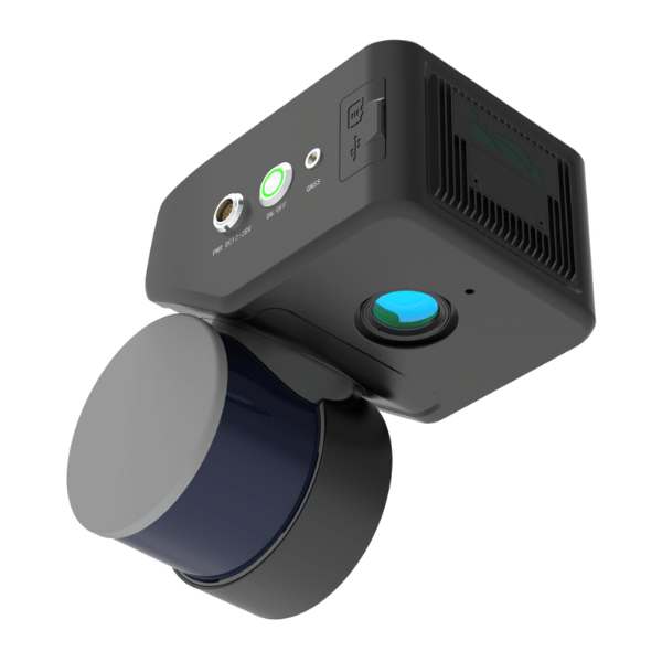
Panoramic camera
| Setting | Value |
| Video resolution | 5760 × 2880 px |
| Registration method | Timelapse (2 s / image) |
| Photo resolution | 18 MP |
| Field of vision | 360° panoramic |
Compatible software
| Function | Software |
| Post-processing | LiDAR360MLS, LiDAR360 |
| Results | Color point cloud, panoramic images, precise measurements |
- Unit LiBackpack DGC50H with dual LiDAR sensor
- Integrated panoramic camera (5.7K)
- Antenna GNSS multiconstellation
- Battery case
- Wiring and adapters
- USB key with LiDAR360MLS software and guides
- User Manual
- Ergonomic backpack (structure included)
- Hard transport case
Recommended with this product
Shipped in 24-48hrs
Free delivery and shipped within 24/48 hours on all orders over $149 in Canada.
Secure payments
Order without fear thanks to secure payment by credit card or PayPal.
You have questions?
Enjoy a fast and certified support from our technicians.