
WingtraGround
The WingtraGROUND is a complete ground configuration kit designed to optimize your drone mapping missions. It ensures accurate data acquisition and increased operational efficiency.
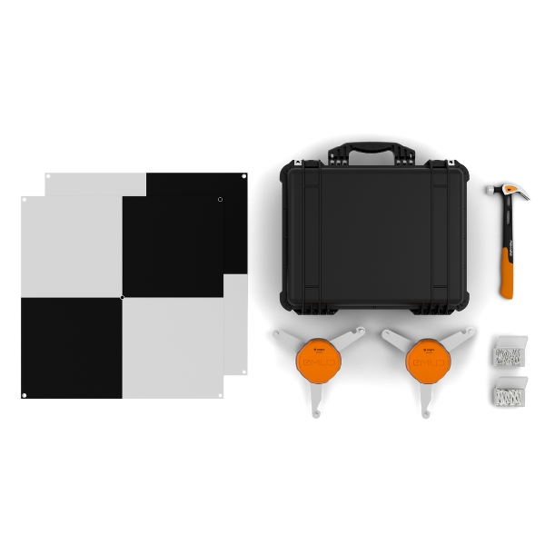
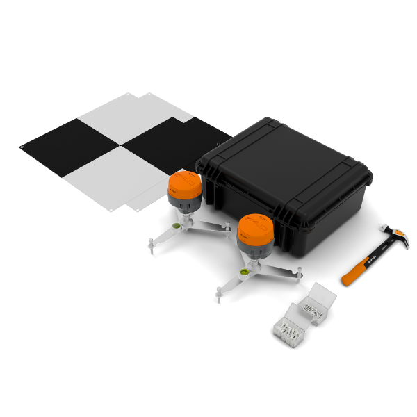
The WingtraGROUND is an integrated solution designed for professionals in mapping and surveying, aimed at improving the accuracy of data collected during drone missions. This kit facilitates the establishment of ground control points (GCP) and GNSS base stations, essential elements to ensure high-quality results.
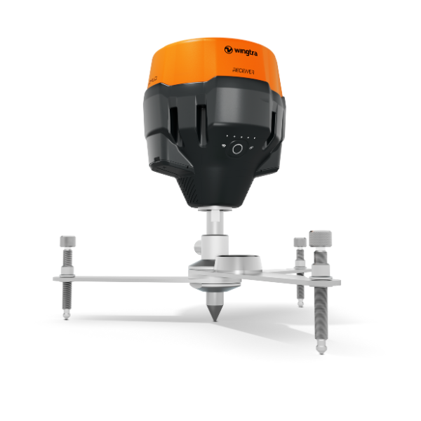
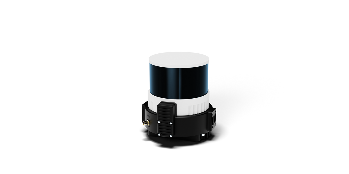
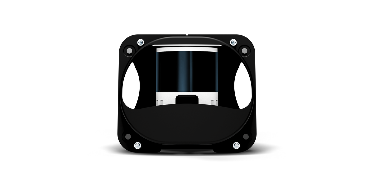
The kit includes two high-precision EMLID receivers, each mounted on a pre-assembled tripod, allowing for quick and stable installation in the field. These receivers ensure effective communication via Bluetooth or Wi-Fi and offer PPK processing options for georeferencing images and mapping.
Six ground control targets are provided to establish precise reference points, essential for accurate mapping. A surveying hammer and nails are included for secure attachment of the targets, ensuring their stability during the surveys. The entire kit is protected by a sturdy transport case, ensuring the safety of the equipment during travel.
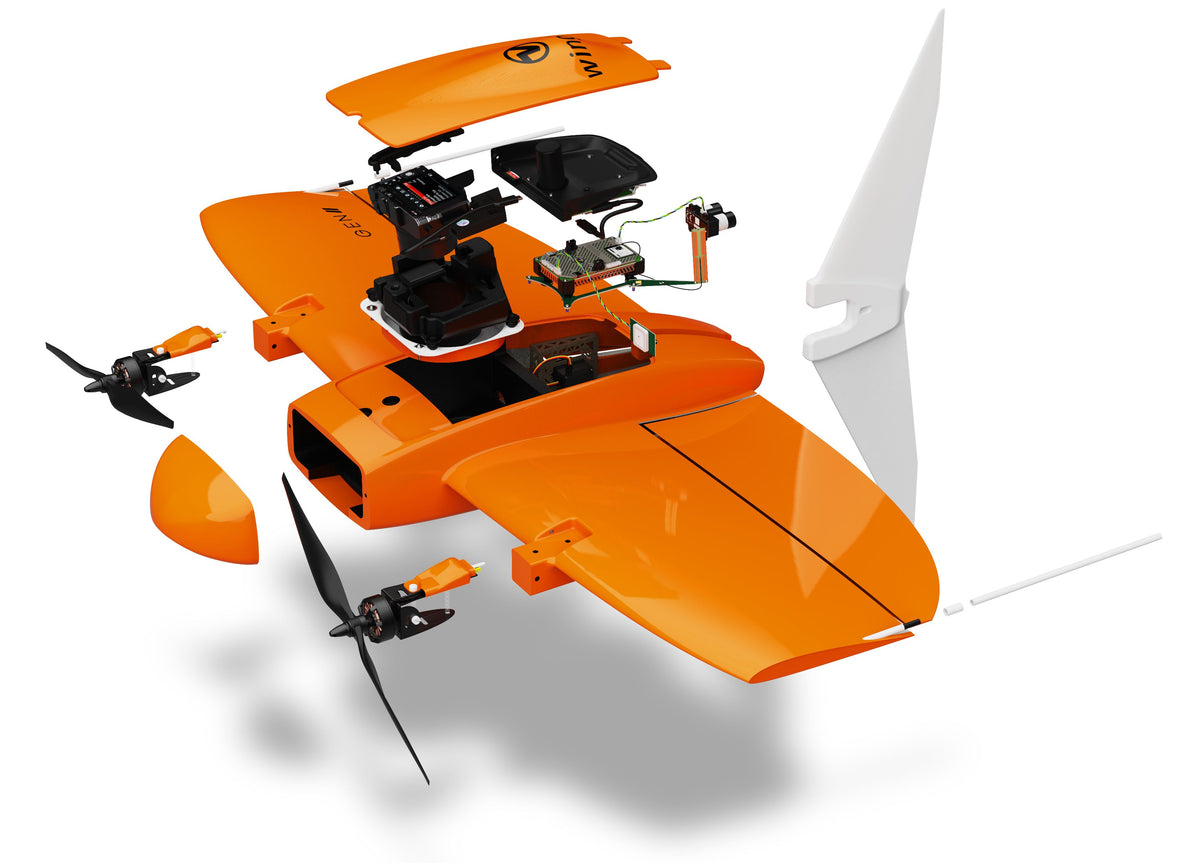
The use of WingtraGROUND in conjunction with the WingtraOne GEN II drone significantly improves the accuracy of the collected data, thereby reducing the need for multiple ground control points and increasing the efficiency of mapping operations.
| Characteristic | Details |
| Base logging | Until 10 p.m. |
| Relative positioning | Yes |
| Configuration on known point | Yes |
| Absolute positioning | Yes |
| PPP (Post-Processing Kinematic) | Coming soon |
| Duration of checkpoint recording | 30 seconds |
| Maximum distance from the base | Up to 10 km for optimal accuracy |
| Integration with WingtraCloud | Yes |
| Precision | 3 cm (0.1 ft) |
| Communication | Bluetooth or Wi-Fi |
| Treatment options | PPK single point processing, PPK image geotagging, Cartographic processing including checkpoints and ground control points |
| Positioning with WingtraRECEIVER | |
| Horizontal precision (H) | 5 mm + 0.5 ppm |
| Vertical precision (V) | 10 mm + 1 ppm |
| Signals followed | GPS/QZSS L1C/A, L2C, GLONASS L1OF, L2OF, BeiDou B1I, B2I, Galileo E1B/C, E5b |
| Number of channels | 184 |
| Weight | 950 g |
| Dimensions | 126 x 126 x 142 mm |
| Waterproofing | Up to 1 meter deep (IP67) |
| Temperature range | -20°C to +65°C |
| Batteries | Li-Ion |
| Battery lifespan | More than 2000 charge and discharge cycles |
| Internal storage | 16 Go |
Recommended with this product

Shipped in 24-48hrs
Free delivery and shipped within 24/48 hours on all orders over $149 in Canada.
Secure payments
Order without fear thanks to secure payment by credit card or PayPal.
You have questions?
Enjoy a fast and certified support from our technicians.